This is not a local authority search (LLC1 or CON29). Open government data, explained. Details
Is this property in a conservation area?
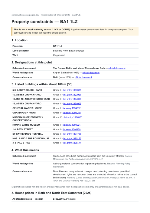
See the report. A real one, from the same program as orders: the Roman Baths in Bath, with its conservation area, World Heritage Site and 33 listed buildings nearby.
Machine access and service level
The service level we impose on ourselves
Regulation (EU) 2023/138 requires Member States to publish certain datasets — so-called high-value — free of charge, machine-readable, with an API and bulk download. We apply that level to this register, whether the law requires it or not.
- Free of charge — every page and every machine file on this site is freely accessible, with no account and no key.
- Machine-readable — manifest, field schema, real sample.
- With an API — 6 callable tools, described with their input schema and wired into the page for an agent.
- And as a bulk download — 97 fragments covering the whole dataset, enumerable and free.
⚠️ This register is not designated « high-value » in the legal sense: it is a service level we impose on ourselves, not a regulatory guarantee. Details for agents · catalogue.
Machine access8/9
This is not a badge: every line points to the file that proves it, and the only missing one is listed too.
- servedversioned manifest
- servedfield schema, with fill rates
- servedreal sample, read from a served fragment
- servedtools declared and served
- servedfree bulk download
- servedcallable MCP server
- servedllms.txt
- servedreal 404 page
- missinglog of agent visits to THIS site